-
Systane eye drops recalled due to potential fungal contamination - 8 mins ago
-
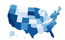
Map Shows States Most Vulnerable to Identity Theft and Fraud In 2025 - 30 mins ago
-
2024 NFL odds: Back Lions to win, cover at 49ers - 33 mins ago
-
Finland seizes Russia-linked tanker suspected of cutting vital undersea cables - 43 mins ago
-
The holiday gift return rush has started. Here’s what to know before you send back unwanted presents. - 46 mins ago
-
Bird Flu Updates: Virus Mutation in First Severe Human Case in U.S. May Increase Transmission - about 1 hour ago
-
2024 NFL odds: Vikings-Packers tilt is a pick ’em, as Minnesota vies for NFC’s 1-seed - about 1 hour ago
-
Jon Bon Jovi ‘got away with murder,’ Martha Stewart’s ‘affair’: Wild celebrity marriage confessions of 2024 - about 1 hour ago
-
Azerbaijan Airlines says doomed flight saw ‘external and technical interference’ before it crashed - 2 hours ago
-
Universities Performing Well despite EU Erasmus Ban, Minister Says - 2 hours ago
Are you at risk of tsunami flooding in California? Check these maps
California’s coastal areas are obviously at highest risk from an incoming tsunami. But how far inland does the threat extend?
The answer might surprise you. Tsunami hazard areas can be quite large depending on the location, and in some cases, they are home to large numbers of people.
A large swath of Venice and all of Marina del Rey are in a tsunami hazard area. So are wide sections of Long Beach, including Belmont Shore, Naples Island and the city Convention Center.
Significant segments of Orange County are also at risk. They include Newport Beach’s Balboa Island and Balboa Peninsula, as well as neighborhoods in Sunset Beach and Seal Beach.
Even where tsunami hazard zones are relatively narrow, many Californians may not have the instinct to get to higher ground after the ground shakes.
The Malibu Village mall is separated from the coast by two rows of houses, a golf course and Pacific Coast Highway, yet is still at risk because of its proximity to not just the ocean but also Malibu Lagoon.
And the risk can vary. The tsunami hazard area in Manhattan Beach is essentially limited to the beach and pier on the coastal side of the Strand, the walking-and-biking path that separates the sand from luxury homes. Yet in Hermosa Beach, the tsunami hazard area also covers the pricey homes a block or so east of the trail.
Visiting SeaWorld in San Diego? The theme park is outside the hazard zone, but some hotels and resorts to the west and north are not. Checking out San Francisco’s Ferry Building? There’s no need to flee the city — walking a few blocks inland could be all you need to do to get to safety.
And not all tsunamis will flood the entire hazard zone. If a tsunami is, say, more than four hours away from arriving, officials may be able to issue fine-tuned orders that will limit the scope of the evacuated area. But if a tsunami is coming in a shorter period of time, authorities may decide to simply evacuate the entire zone as a precaution.
Tsunami hazard zones represent the maximum inundation area in a number of extreme yet realistic scenarios, the California Geological Survey says.
If you’re uphill or inland from the zones, you should be safe from any tsunami. That’s why officials say it’s important to know whether you live, work or play in a hazard zone. Experts recommend knowing how you will evacuate and where you need to go.
But if you don’t have prior knowledge of whether you’re in a tsunami hazard zone, and no maps or evacuation signs are available, aim for spots 100 feet above sea level and as far as two miles inland, if possible, officials say.
Given geography, density and access, some areas could be particularly challenging to evacuate in the event of an earthquake-spawned tsunami.
“There are places on the U.S. West Coast, and here in Alaska, where an entire safe evacuation for a near-shore event … would [have] a much lower success rate,” said Dave Snider, the tsunami warning coordinator at the National Tsunami Warning Center in Alaska. “That is the No. 1 reason why people need to understand what their hazard zone is ahead of time.”
An example of a hard-to-evacuate area could be the ports of Los Angeles and Long Beach. But in Laguna Beach, advance knowledge of the tsunami hazard area shows that it’s relatively small, and walking a few blocks away could make a difference.
While rare, a tsunami could arrive just minutes after the earth shakes, depending on the location. Snider said the tsunami warning from last week — issued in the wake of a magnitude 7.0 quake that struck 30 miles off the coast of Humboldt County — is a good reminder that this type of event is a real concern.
“You just experienced a significant alert — one that may never happen again to you,” Snider said. “But in the event that it does … ask yourselves, did I have alerts when I needed them?”
Those who were ordered to leave during last week’s widespread warning should use the experience to assess whether their evacuation plan worked and if they need to change it, Snider said. Those who live in higher-risk areas should also, ideally, have a go-bag ready, he added.
Here are maps showing some of Southern and Central California’s most populated areas within a tsunami hazard zone, as determined by the California Geological Survey. The yellow section indicates the tsunami hazard area.
Downtown San Diego and Coronado
Laguna Beach
The tsunami hazard area in Laguna Beach.
(California Geological Survey)
Newport Beach
Seal Beach and the surrounding area
Long Beach
Redondo Beach and Hermosa Beach

The tsunami hazard area in the westernmost neighborhoods of Hermosa Beach and the pier area of Redondo Beach.
(California Geological Survey)
Marina del Rey and Venice
Malibu
Ventura County
Santa Barbara County

The tsunami hazard area in Santa Barbara County includes part of the city of Carpinteria.
(California Geological Survey)

The tsunami hazard zone includes the Stearns Wharf area in Santa Barbara, a popular tourist destination.
(California Geological Survey)
San Luis Obispo County

Parts of Pismo Beach and Grover Beach, in San Luis Obispo County, are in the tsunami hazard area.
(California Geological Survey)

Parts of Avila Beach are in the tsunami hazard area.
(California Geological Survey)

Parts of Morro Bay and Cayucos are in a tsunami hazard area.
(California Geological Survey)
Source link


