-
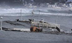
Santa Cruz’s 100-year-old wharf keeps getting thrashed - 21 mins ago
-
Pete Carroll reportedly eyeing return to coaching, targeting Bears - 24 mins ago
-
Domestic Ski Season Kicks Off After Christmas - 26 mins ago
-
Petition To Ban Reclining Airplane Seats Reaches 200,000 Signatures - 37 mins ago
-
Annual Foreign Labor Quota to Be Lowered in 2025 - 59 mins ago
-
Heat president Pat Riley addresses trade rumors: ‘We are not trading Jimmy Butler’ - about 1 hour ago
-
Is Azerbaijan Safe to Visit? Travel Information After Plane Crash - about 1 hour ago
-
Trade surplus reaches EUR 1 billion - about 1 hour ago
-
Budapest Hotel Hosts Exclusive Holiday Wine Tasting - 2 hours ago
-
HGTV star in ‘state of fear’ over raising daughters with discipline without crushing spirit - 2 hours ago
Map Shows 11 States Getting Hit by Atmospheric River
National Weather Service (NWS) meteorologists have issued a flood watch for several Northeastern states, with an atmospheric river bringing a deluge of rain to the area on Wednesday.
Impacts from the atmospheric river, which is forecast to intensify into a bomb cyclone, will extend from North Carolina through Maine, causing widespread travel delays, flooding and power outages. Heavy rain and strong winds are expected.
The biggest flood threats will hit Maryland, Delaware, Pennsylvania, New Jersey, Connecticut, Rhode Island, Massachusetts, New York, Vermont, New Hampshire and Maine, an AccuWeather forecast said. Wind impacts will extend farther south.
A bomb cyclone occurs when a storm’s pressure drops quickly, which intensifies the storm and ramps up wind gusts. Atmospheric rivers are a “long, narrow region in the atmosphere—like rivers in the sky—that transport most of the water vapor outside of the tropics,” according to the National Oceanic and Atmospheric Administration.
Scott Eisen/Getty
Known for their ability to produce heavy rain across the West Coast that results in significant flooding, such storms can also set up along the East Coast, AccuWeather Chief Meteorologist Jonathan Porter told Newsweek.
One of the biggest concerns regarding the storm’s impacts is flooding. A flood watch has been issued across much of the Northeast as of Wednesday morning.
“This atmospheric river will be unusually potent and moisture-loaded, delivering tropical moisture into the intensifying storm from the Caribbean Sea, some 2,000 miles away from eastern New England,” Porter said. “The result will be heavy rain and the risk of significant flooding, especially near streams and creeks. Some roadways may be closed by flooding.”
Widespread rain between 2 and 4 inches is expected, with local amounts up to 8 inches.
High-elevation areas in Vermont, New Hampshire and Maine carry the biggest flood risk. Heavy snow recently fell across the area. Once it melts, it will add up to another 2 inches of water through runoff.
“Heavy rainfall rates in combination with snowmelt late tonight could trigger flash flood conditions,” the NWS office in Gray, Maine, warned. “The area of greatest concern is in the foothills where the combination of rain and snowmelt will be highest. In the mountains the colder and drier snowpack will limit the flood extent, but isolated ice jams and rapid runoff from area hills could cause localized flooding. Rapid rises in small streams is likely.”
All of Vermont faces a flood risk save for Grand Isle County, NWS meteorologists in Burlington said.
“Heavy rain may fall on a deep primed snowpack leading to the melt increasing,” the flood watch from that office said. “Flows in rivers may increase quickly and reach critical levels.
Source link


