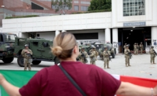
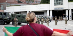
Tsunamis pose a risk to the entire California coast. But should a major one strike, how bad could it be?
A single tsunami likely won’t cause the worst-case scenario for every region. But in total, more than 680,000 Californians are in a tsunami hazard area during the daytime. And in all, $12.6 billion in damage is possible across California’s 20 coastal and bayside counties — a figure that doesn’t include damage to ports, harbors, roads, essential facilities or other infrastructure.
There are two main types of scenarios for a tsunami. The first, a “distant-source” tsunami, comes from far away, like one spawned by a major earthquake in Alaska. That would provide an extensive warning — six hours for L.A. and five hours for San Francisco — but could produce the highest level of inundation for large swaths of the state.
Then there are “near-source” tsunamis, which can wash ashore in as little as 10 minutes following a nearby earthquake — leaving little time for a notice or evacuation.
Here are some scenarios for different parts of California. Unless otherwise mentioned, figures are from the California Tsunami Program, which is run by the California Governor’s Office of Emergency Services and the California Geological Survey.
Southern California
Distant-source tsunami: More than 350 people could die or be injured along the Southern California coast if people wait to evacuate half an hour after an official evacuation warning is given. That includes about 200 casualties in Los Angeles County, roughly 80 in San Diego County, 60 in Orange County and about a dozen in Ventura County.
A hypothetical magnitude 9.3 earthquake from Alaska — similar in scale to the monstrous 1964 tsunami-generating temblor — would offer six hours of warning; large temblors from Chile could provide 13 hours of warning.
The maximum projected distant-source tsunami could bring waves of 15 feet above the mean sea level to Marina del Rey, the Santa Monica Pier, Naples and Alamitos Bay; 14 feet elsewhere in other parts of Long Beach; 10 feet at Manhattan Beach, San Pedro and the ports of Los Angeles and Long Beach; 9 feet in Malibu, Redondo Beach and Palos Verdes Hills; and 8 feet at Leo Carrillo State Beach.
Those estimates were issued by the California Geological Survey and published in the city of Los Angeles’ hazard mitigation plan.
Damage estimate from distant-source tsunami: More than $1.4 billion.
Near-source tsunami: Los Angeles could see a tsunami move from its source to coastal areas in as few as 10 or 15 minutes, the city’s tsunami plan warns. According to public documents, depending on the fault that ruptures, or where an underwater landslide is triggered, there could be locally generated tsunami heights of 30 feet in Avalon on Catalina Island; 24 feet at Palos Verdes Hills; 18 feet in Two Harbors; 11 feet in Redondo Beach; 9 feet in Malibu; 8 feet in Long Beach and the Santa Monica Pier; 7 feet in Manhattan Beach and San Pedro; 5 feet in Marina del Rey; and 4 feet at Leo Carrillo State Beach.
In the city of Los Angeles, officials say that the most catastrophic scenario would involve an underwater landslide triggered by an earthquake, because “we wouldn’t know that that landslide would occur until the wave arrives,” said Jon Brown, assistant general manager for the city’s Emergency Management Department.
Other L.A. County areas with considerable vulnerability include the ports, as well as San Pedro and Long Beach. The city of Los Angeles has an estimated 23,000 residents in the tsunami hazard area. In Long Beach, the number is 31,000.
Central Coast
Distant-source tsunami: More than 230 people could die or be injured if people wait half an hour to evacuate after an official warning is given. Santa Cruz County could see more than 130 casualties; San Luis Obispo County, about 80. The estimated potential casualty tolls could be 16 in Monterey County and seven in Santa Barbara County.
Damage estimate from distant-source tsunami: More than $3.5 billion.
Near-source tsunami: Santa Cruz and Monterey counties could see a tsunami within minutes following quake-triggered underwater landslides, documents from both counties say. “Even a moderate earthquake could cause a local-source tsunami from submarine landsliding in Monterey Bay,” public documents say.
A near-source tsunami could bring waves of up to 15 feet above the mean sea level in the city of Marina, 9 feet at the Salinas River; 8 feet at the Pajaro River and Sand City, just northeast of Monterey, and 6 feet at Moss Landing, according to data published in Monterey County’s hazard mitigation plan.
Such devastation would not be unprecedented. A large earthquake in the Santa Barbara area in 1812 resulted in a tsunami “that wiped out many coastal villages and destroyed ships in the harbor,” according to the U.S. Geological Survey.
And 7-foot waves resulted from a tsunami in 1927, generated by an earthquake about 5 miles west of the Santa Barbara County coast, according to the California Geological Survey.
The USGS said there’s evidence of deposits from underwater landslides offshore of Santa Barbara dating back over 160,000 years, which suggests that “future earthquakes could cause large submarine landslides and devastating tsunamis.”
Bay Area
Distant-source tsunami: More than 1,300 people could die or be injured if people wait half an hour to evacuate after an official warning is given. About 500 of them could be in San Francisco; about 300 apiece in San Mateo and Marin counties; nearly 200 in Alameda County and 33 in Contra Costa County. Just north of the region, in Mendocino County, five people could die or be injured in that scenario.
A hypothetical tsunami-generating earthquake in Alaska could provide 5 hours of warning; one from Chile could provide 13 hours of warning.
The maximum projected distant-source tsunami could result in tsunami of 32 feet above mean sea level in San Francisco’s Ocean Beach; 31 feet in Pacifica in San Mateo County; 27 feet in Bolinas in Marin County; 18 feet in Alameda; 14 feet in Sausalito and San Francisco’s Aquatic Park; 13 feet on Alcatraz Island; and 11 feet in Richmond and Treasure Island, according to the California Geological Survey.
Damage estimate from distant-source tsunami: More than $6.5 billion.
Near-source tsunami: In Northern California, a near-source tsunami could generate a tsunami of 9 feet above sea level in Bolinas; 8 feet in Pacifica; 7 feet in Sausalito; 6 feet at Ocean Beach; 5 feet in Alameda; and 4 feet at Alcatraz Island, Treasure Island, Aquatic Park, Redwood City and Richmond.
North Coast
Cascadia scenario: Given its proximity to the Cascadia subduction zone, Del Norte County — the state’s northernmost coastal region — is perhaps more exposed to tsunami risk than any other part of California. If people wait 10 minutes after an earthquake to evacuate — the shaking itself would be the warning to flee — more than 3,150 are at risk of being killed or injured by tsunami in Del Norte County, and more than 720 would be at risk in neighboring Humboldt County.
Flooding could reach up to 30 feet above the average high tide along the outer coast of Humboldt Bay and the Eureka area, and up to 50 feet toward Crescent City.
“A large quake generated by the Cascadia subduction zone could create waves twice as large as the 1964 event, especially in Crescent City,” Rick Wilson, a former head of the California Geological Survey tsunami program, said in a statement.
Damage estimates: Del Norte County, which is home to Crescent City, could see more than $1 billion in damage. Humboldt County, home to Eureka, could see $22 million.