Gifford Fire Map, Update as California Blaze Hits Major Milestone
1 day ago
2,022
The Gifford fire in central California has burned more than 100,000 acres as of Friday, becoming the state’s largest blaze of the year so far.
Newsweek has contacted the California Department of Forestry and Fire Protection (CAL FIRE) for further comment via an email sent outside regular business hours.
Why It Matters
The fire is threatening thousands of homes and other structures near the Los Padres National Forest and has prompted widespread evacuation orders in the Golden State.
Five firefighters and three civilians had been injured as of Friday afternoon, according to a Friday update from CAL FIRE.
What To Know
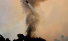
The Gifford fire, which broke out on August 1 along Highway 166, has burned more than 104,000 acres of San Luis Obispo and Santa Barbara counties, according to CAL FIRE. It was 21 percent contained as of Friday evening.
The fire “is burning actively on both sides of the highway with more active spread on the south side,” CAL FIRE said in a situation summary on Friday. At least 3,600 personnel are battling the blaze.
It erupted from multiple smaller fires between Santa Maria and Bakersfield.
A map shows the spread of the Gifford Fire as of August 8. A map shows the spread of the Gifford Fire as of August 8. CAL FIRE
It has now surpassed the Madre Fire, which erupted last month in southeastern San Luis Obispo County, and burned more than 80,000 acres before it was contained.
Evacuation orders and warnings are in effect for multiple zones in San Luis Obispo and Santa Barbara counties. Full details on the orders and warnings can be found on the CAL FIRE website.
Meanwhile, the Canyon fire, which ignited on Thursday afternoon, has burned more than 5,000 acres in Ventura and Los Angeles counties. It was 29 percent contained as of Friday evening.
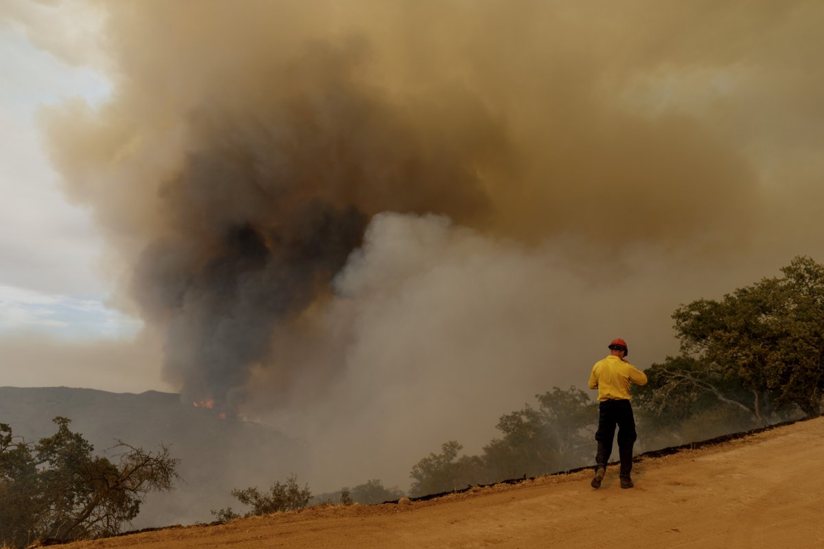
A firefighter watches as the Gifford Fire burns on August 6 in Los Padres National Forest, California. A firefighter watches as the Gifford Fire burns on August 6 in Los Padres National Forest, California. Eric Thayer/Getty Images
What People Are Saying
The U.S. Forest Service-Los Padres National Forest said in an update on Friday evening update that “due to erratic fire behavior, residents should watch for changing conditions in their area.”
The California Governor’s Office of Emergency Services wrote on X on Friday: “As firefighters battle the #CanyonFire and #GiffordFire, it’s important to stay alert NOW and throughout fire season. If told to evacuate, don’t wait.”
CAL FIRE wrote on X on Friday: “California is under a heat wave, bringing hot, dry, and windy conditions, making wildfires more likely to occur and to spread fast. When temps soar, even a tiny spark can ignite disaster.”
The post added that Californians can protect themselves, their homes and their communities by securing trailer chains to avoid sparks on the road, avoiding the use of spark-producing equipment, not parking or driving over dry grass and avoiding open flame activities like grilling campfires.
What Happens Next?
The cause of the fires remain under investigation.
Meanwhile, the U.S. Forest Service-Los Padres National Forest wrote in its update on Friday that hot and dry conditions will continue across the area through early next week.
“Temperatures will climb into the 90s to around 100 degrees while humidity drops into the teens and single digits,” it wrote. “With typical diurnal winds anticipated, elevated fire weather conditions can be expected into early next week.”
A legjobb élmény biztosítása érdekében olyan technológiákat használunk, mint a cookie-k az eszközadatok tárolására és/vagy eléréséhez. Ha beleegyezik ezekbe a technológiákba, akkor olyan adatokat dolgozhatunk fel ezen az oldalon, mint a böngészési viselkedés vagy az egyedi azonosítók. A hozzájárulás elmulasztása vagy visszavonása bizonyos funkciókat és funkciókat hátrányosan érinthet.
Functional
Always active
The technical storage or access is strictly necessary for the legitimate purpose of enabling the use of a specific service explicitly requested by the subscriber or user, or for the sole purpose of carrying out the transmission of a communication over an electronic communications network.
Preferences
The technical storage or access is necessary for the legitimate purpose of storing preferences that are not requested by the subscriber or user.
Statistics
The technical storage or access that is used exclusively for statistical purposes.The technical storage or access that is used exclusively for anonymous statistical purposes. Without a subpoena, voluntary compliance on the part of your Internet Service Provider, or additional records from a third party, information stored or retrieved for this purpose alone cannot usually be used to identify you.
Marketing
The technical storage or access is required to create user profiles to send advertising, or to track the user on a website or across several websites for similar marketing purposes.