-
Liam Lawson opens up on Daniel Ricciardo Support message - 4 mins ago
-
Joel Klatt’s College Football Rankings: Ohio State Continues to Solidify Its No. 1 Spot - 17 mins ago
-
Budapest Statue of Margaret Thatcher Honors the ‘Iron Lady’s’ Legacy - 23 mins ago
-
Woman's brutal killing hidden by trailer park fire - 38 mins ago
-
Josh Allen’s Message to Stefon Diggs After Patriots Upset Bills Revealed - 43 mins ago
-
Ozzy Osbourne considered suicide after botched neck surgery complications - 45 mins ago
-
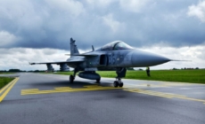
Our Gripens Halfway Through Their Baltic Mission with over 50 Takeoffs - 56 mins ago
-
NFL, CFB Weekend Betting Recap: Huge Underdogs Help Books Win Big - 60 mins ago
-
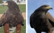
One of two hawks stolen from SoFi Stadium during Rams game is found - about 1 hour ago
-
Cubs Lose 4-Year Veteran To Free Agency After Letdown Season - about 1 hour ago
US and Chinese Satellites Track Each Other in Space: Photos
The space race between the United States and China remains contested, with their satellites taking turns tracking each other in Earth’s orbit, according to latest imagery.
Newsweek has emailed Maxar Technologies—a U.S. satellite imagery company whose satellite was captured in images by a Chinese counterpart—for comment. The Chinese Foreign Ministry did not immediately respond to a written request for comment.
Why It Matters
Space is part of the broader strategic competition between the U.S. and China, where both countries seek dominance. Following the establishment of the U.S. Space Force in 2019, the Chinese People’s Liberation Army founded the Aerospace Force in 2024, tasked with integrating space-based surveillance, targeting and offensive capabilities.
U.S. and Chinese military and space operations have often been captured in satellite imagery in recent years, including American force deployments at strategic bases and China’s reconnaissance satellite, providing the public with rare insight into sensitive and secretive activities and demonstrating both nations’ space situational awareness.
What To Know
China’s Chang Guang Satellite Technology shared images taken by its Jilin-1 satellites on September 8, showing a Maxar Technologies WorldView Legion 2 satellite. One of the WorldView Legion satellites also captured imagery of China’s ShiJian-26 satellite in June.
According to the U.S. Air Force’s China Aerospace Studies Institute, Chang Guang Satellite Technology is closely affiliated with the Chinese People’s Liberation Army, with its Jilin satellites providing remote sensing capabilities to the country’s military.
More than 100 Jilin remote sensing satellites have been launched, designed to acquire information from space via remote instruments. The Chinese company said its satellites provide high-quality remote sensing data for the construction of a “digital China.”
Meanwhile, Susanne Hake, general manager of Maxar Intelligence’s U.S. government business, shared an August 21 image taken by a WorldView Legion satellite on social media, showing a SpaceX Starlink satellite orbiting over Dingxin Air Base in China.
Hake said the company’s satellites were conducting routine operations at the time. She described the image as showing an interconnected orbital ecosystem where satellites—tasked with different missions—”share the same highways 340 miles above our heads.”
Regarding the Chinese air base, the defense outlet The War Zone reported that the massive military facility in the Gobi Desert supports the country’s air force tactics and weapons development, as well as advanced training in “high-end, complex scenarios.”
SpaceX
What People Are Saying
Susanne Hake, general manager of Maxar Intelligence’s U.S. Government business, wrote in a post on LinkedIn: “The ‘crowded’ space domain isn’t just about collision avoidance anymore—it’s about understanding how these overlapping capabilities create both opportunities and complexities for mission planning. That’s why integrated space domain awareness isn’t just nice-to-have anymore—it’s foundational to mission success.”
China’s Chang Guang Satellite Technology wrote on its website: “[Jilin-1 satellite constellation] provides high-quality remote sensing information and product services for land security, geographic mapping, land planning, agricultural and forestry production, ecological environmental protection, smart cities and other fields, which is of great significance to the construction of digital China.”
What Happens Next
U.S. and Chinese satellites capturing images of each other and of activities on Earth are likely to continue, as their operators seek to enhance situational awareness in space.
Source link


