California Fire Map, Update as Kenneth, Palisades, Eaton Fires Ravage LA
January 10, 2025
4,570
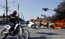
Wildfires that have devastated parts of Los Angeles over the past few days are continuing to rage around the city’s northern and western suburbs, with the Los Angeles medical examiner on Thursday confirming that 10 people have died since the infernos broke out on Tuesday.
At least 10,000 properties have been destroyed across the city according to authorities, with AccuWeather’s chief meteorologist Jonathan Porter describing the blazes as “one of the costliest wildfire disasters in modern U.S. history.”
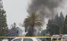
On Thursday the Los Angeles Police Department apprehended a suspect shortly after 4:30 p.m. PT after they were allegedly seen trying to light a fire in Woodland Hills, at the 21700 block of Ybarra Road.
A fire truck puts out a hot spot inside a business along the Mariposa Junction as the Eaton fire continues to burn in Altadena, California, on January 9, 2025. As of Friday morning four main… A fire truck puts out a hot spot inside a business along the Mariposa Junction as the Eaton fire continues to burn in Altadena, California, on January 9, 2025. As of Friday morning four main fires were blazing on the outskirts of Los Angeles.
Kevork Djansezian/GETTY
Speaking to Newsweek Izzy Gardon, communications director for California Governor Gavin Newsom, said: “The Governor is focused on protecting people, not playing politics, and making sure firefighters have all the resources they need.”
As of 3:15 a.m. ET on Friday a map produced by the California Department of Forestry and Fire Protection (CAL FIRE) showed they were battling four main wildfires on the northern and western outskirts of Los Angeles.
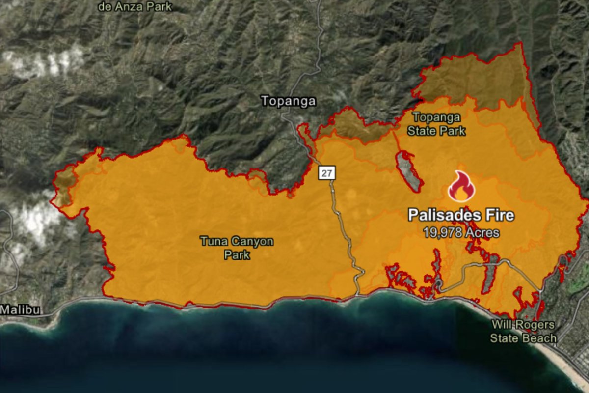
Palisades Fire
The CAL FIRE map showed that the largest blaze by some margin remained the Palisades fire, which has consumed 19,978 acres in an area to the immediate west of Santa Monica, an increase from 15,800 acres on Thursday morning.
At 3:15 a.m. ET on Friday the Palisades fire, which erupted on Tuesday, was only 6 percent contained. Its cause is under investigation.
CAL FIRE map showing the Palisades fire, the largest currently devastating parts of Los Angeles, on Friday morning. CAL FIRE map showing the Palisades fire, the largest currently devastating parts of Los Angeles, on Friday morning. CAL FIRE
Evacuation warnings, meaning there is a “potential threat to life and/or property,” also apply to CAL-C405, CAL-C406, CAL-C407, CAL-C408, CAL-C409, CAL-C410, CAL-C411, CAL-C412, CAL-C413, CAL-C414, CAL-C415, DRY-U026, DRY-U026-B, MAL-C112, MAL-C112-A, MCR-U021-A, RMB-U030-C, SAN-Q1388-C, SAN-Q1389, SAN-Q1395-A and SAN-Q1396-A.
Evacuation shelters have been set up at the Westwood Recreation Center on 1350 South Sepulveda Boulevard, the El Camino Real Charter High School at 5440 Valley Circle Boulevard and the Pasadena Convention Center on 300 E Green Street.
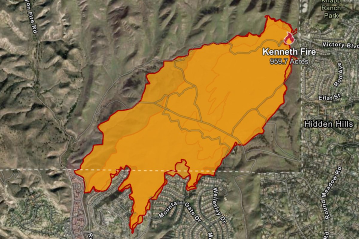
Kenneth Fire
The Kenneth fire, which has burned across 1,000 acres to the north of Calabasas, is the newest of the major fires, first being recorded at 3:34 p.m. on Thursday according to CAL FIRE. The inferno was 35 percent contained as of 3:15 a.m. ET on Friday.
The Kenneth fire developed on Thursday afternoon, making it the newest of the major blazes around Los Angeles. The Kenneth fire developed on Thursday afternoon, making it the newest of the major blazes around Los Angeles. FIRE CAL
CAL FIRE said: “The Kenneth Fire is burning in West Hills in Los Angeles County and rapidly spreading.
“Fanned by strong Santa Ana winds, the fire threatens nearby communities and infrastructure, prompting swift evacuation orders. Firefighters from Los Angeles and Ventura counties are actively engaged in containment efforts, deploying both ground crews and aerial resources. The challenging terrain and persistent winds complicate suppression activities.”
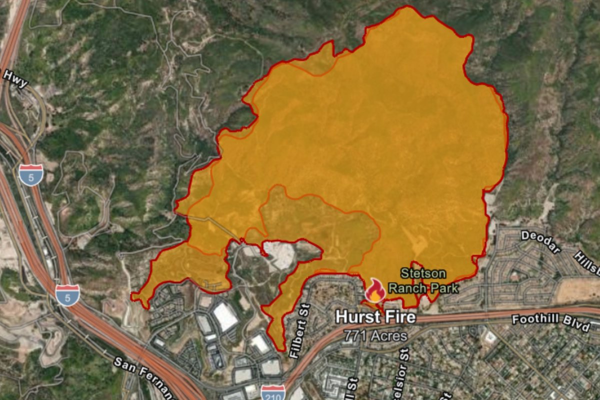
Hurst Fire
The Hurst fire, which began on Tuesday, had burned over 771 acres as of early Friday morning, and had been 37 percent contained.
The blaze is situated to the north of San Fernando. An evacuation order had been in place for much of the local area, but this was lifted at 3 p.m. PT on Thursday.
The Hurst fire had burned its way across 771 acres by Friday morning. The Hurst fire had burned its way across 771 acres by Friday morning. CAL FIRE
Evacuation warnings remain in place for LAC-E119-B, LAC-E132-B and LOS-E001.
Ritchie Valens Recreation Center, on 10736 Laurel Canyon Blvd., has been turned into an evacuation shelter for those impacted by the Hurst fire. Large animal shelters are also available at the Los Angeles Equestrian Center, Industry Hills Expo, Pomona Fairplex and Castaic Animal Care Center.
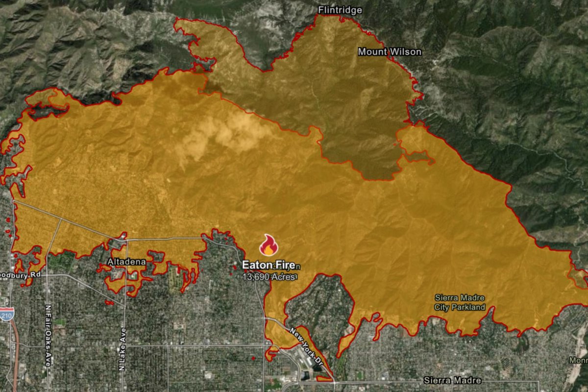
Eaton Fire
The Eaton fire had burned through 13,690 acres to the north of Pasadena as of early Friday morning, up from an estimated 10,600 acres the previous morning. Command over the containment operation is being led by the Los Angeles County Fire Department, Pasadena Fire and the United States Forest Services.
According to CAL FIRE the blaze began on Tuesday evening and its cause is still being investigated.
The Eaton fire had consumed 13,690 acres north of Pasadena by early Friday morning. The Eaton fire had consumed 13,690 acres north of Pasadena by early Friday morning. CAL FIRE
CAL FIRE said: “Firefighters are working aggressively to slow the spread and protect critical infrastructure under extreme conditions. Multiple structures have been damaged or destroyed as the wind-driven brush fire continues…
“The combination of low humidity, dry fuels, and shifting winds has heightened the potential for spot fires and rapid expansion.”
Evacuation orders remains in place for a number of areas, meaning there is a lawful order to leave immediately. These are situated north of Orange Grove/Rosemead Blvd., east of Lake Ave., and west of Michillinda Ave.
The Arcadia Community Center, El Camino Real Charter High School, Pasadena Convention Center, Pomona Fairplex and Westwood Recreation Center have all been turned into evacuation shelters.
A legjobb élmény biztosítása érdekében olyan technológiákat használunk, mint a cookie-k az eszközadatok tárolására és/vagy eléréséhez. Ha beleegyezik ezekbe a technológiákba, akkor olyan adatokat dolgozhatunk fel ezen az oldalon, mint a böngészési viselkedés vagy az egyedi azonosítók. A hozzájárulás elmulasztása vagy visszavonása bizonyos funkciókat és funkciókat hátrányosan érinthet.
Functional
Always active
The technical storage or access is strictly necessary for the legitimate purpose of enabling the use of a specific service explicitly requested by the subscriber or user, or for the sole purpose of carrying out the transmission of a communication over an electronic communications network.
Preferences
The technical storage or access is necessary for the legitimate purpose of storing preferences that are not requested by the subscriber or user.
Statistics
The technical storage or access that is used exclusively for statistical purposes.The technical storage or access that is used exclusively for anonymous statistical purposes. Without a subpoena, voluntary compliance on the part of your Internet Service Provider, or additional records from a third party, information stored or retrieved for this purpose alone cannot usually be used to identify you.
Marketing
The technical storage or access is required to create user profiles to send advertising, or to track the user on a website or across several websites for similar marketing purposes.