-
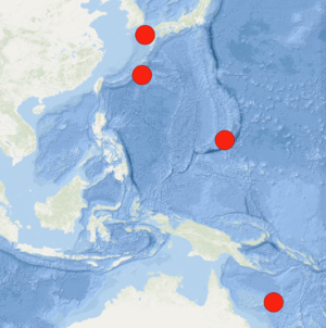
Map Shows Major US Naval Presence in West Pacific Amid China Rivalry - 13 mins ago
-
Ukraine’s EU Bid Should Not Precede Serbia’s, Believes FM Szijjártó - 19 mins ago
-
Menczer condemns ‘attack’ by Ukrainian journalist on government’s Vote 2025 survey - 23 mins ago
-
Josh Hines-Allen says Travis Hunter ‘is a baller,’ talks Trevor Lawrence’s expectations | Speak - 28 mins ago
-
At least 36 killed in India after explosion at a pharmaceutical factory - 32 mins ago
-
Donald Trump Perfume Goes on Sale: Here’s What It Smells Like - 52 mins ago
-
Nézőpont Institute: Fidesz won the debate around the Pride march - 56 mins ago
-
Yankees vs. Blue Jays Highlights | MLB on FOX - about 1 hour ago
-
Prince William rules out royal role for Andrew in future monarchy: experts - about 1 hour ago
-
Balaton Park Circuit Gears Up for Superbike and MotoGP - about 1 hour ago
Washington, DC, Rain Forecast—Live Tracker
Washington, D.C., is experiencing above-average temperatures as a warm front moves through the region, with a high near 55°F today and a low around 30°F. While the chance of precipitation remains low for the next 24 hours, a wintry mix is expected to develop midweek, bringing potential snowfall, sleet, and freezing rain.
Why It Matters
This February has already shown a notable deviation from historical averages, with today’s temperature of 42.5°F being 4.5°F warmer than the five-year average of 38°F. The ongoing warming trend highlights shifting weather patterns and potential implications for infrastructure, transportation, and public safety. Additionally, the National Weather Service has issued winter storm watches for parts of Maryland, West Virginia, and Virginia due to the risk of significant ice accumulation in the coming days.
What To Know
Today: Partly sunny, becoming clear, with a high near 55°F and a low of 30°F.
Five-Year Trend: February 4 has trended warmer in recent years, with the most extreme deviation occurring in 2020 when the temperature reached 57°F, 18.9°F above the historical norm.
Precipitation Data: The five-year average precipitation for February 4 stands at 0.08 inches, with an average snow depth of 0.2 inches.
Washington, DC, Upcoming Weather Forecast
According to the National Weather Service, Washington, D.C., will experience a mix of winter weather conditions over the next week.
- Wednesday, February 5: A slight chance of snow and sleet before 10 a.m., then a chance of sleet. Cloudy, with a high near 38°F. Chance of precipitation is 30%.
- Wednesday Night: Freezing rain, possibly mixed with sleet before 4 a.m., then rain or freezing rain. Low around 31°F. Chance of precipitation is 100%. New ice accumulation of 0.1 to 0.2 of an inch possible. New sleet accumulation of less than a half inch possible.
- Thursday, February 6: Rain, mainly before 1 p.m. High near 45°F. Chance of precipitation is 90%.
- Thursday Night: A chance of rain before 1 a.m. Mostly cloudy, with a low around 40°F. Chance of precipitation is 30%.
- Friday, February 7: Mostly sunny, with a high near 52°F.
- Friday Night: Mostly cloudy, with a low around 30°F.
- Saturday, February 8: Wintry mix likely. Cloudy, with a high near 40°F. Chance of precipitation is 60%.
- Saturday Night: Rain likely. Cloudy, with a low around 38°F. Chance of precipitation is 70%.
- Sunday, February 9: A chance of rain. Mostly cloudy, with a high near 56°F. Chance of precipitation is 30%.
What People Are Saying
In a post on X, formerly Twitter, the NWS in Washington D.C. said, “A cold front moves through this morning which will bring an increase in NW winds. Expect above normal temperatures with increasing sunshine late. Heading into Wed through Thu morning, a wintry mix is likely to impact the area, particularly on Wed night.”
What’s Next
As the warm front moves through, temperatures are expected to rise above normal before a cold system brings freezing rain and sleet midweek. Residents should prepare for potential icy road conditions and monitor weather updates as winter storm watches remain in effect for surrounding states.
Windy.com
Source link


