-
Interview with Rheinmetall Hungary CEO, Paul Walf - 8 mins ago
-
Athletics vs. Angels Highlights | MLB on FOX - 10 mins ago
-
Harrison Butker’s Comments on Olympics Opening Ceremony Goes Viral - 20 mins ago
-
Rockies vs. Giants Highlights | MLB on FOX - 53 mins ago
-
Archaeologists Find Ancient Egyptian Artworks Hidden Below Nile Waters - about 1 hour ago
-
Cubs vs. Royals Highlights | MLB on FOX - 2 hours ago
-
Woman Explains Why She Decided To Have Rescue Dog Euthanized Over Behavior - 2 hours ago
-
On this day in history, July 27, 1940, Bugs Bunny debuts in animated film ‘A Wild Hare’ - 2 hours ago
-
Tuzson: Attacks on sovereignty more and more open - 2 hours ago
-
Trump Warns of Vote Rigging, Asks Christians to Vote ‘Just This Time’ - 2 hours ago
How climate change is projected to alter California flooding, storms
Scientists have long known that as the atmosphere gets warmer, the air is able to hold more moisture. With higher temperatures, the humidity in a storm can increase to a greater degree before that water vapor condenses into rain.
“In general, this allows the most intense downpours to get more intense, because there can be a greater amount of water vapor in the air,” UCLA atmospheric scientist Karen McKinnon said. “However, it’s not yet clear if we are seeing this signal in the Western U.S. and California, although we do expect to see it in the future.”
An aerial view of a Beverly Crest home that was pushed off its foundation by a mudslide caused by heavy rainfall in Los Angeles.
(Allen J. Schaben / Los Angeles Times)
Much of the precipitation in California and the West comes from major storms called atmospheric rivers that sweep in from the Pacific. Scientists have projected that atmospheric rivers will grow more potent as temperatures continue to rise, and will become an even more dominant driver of California’s water supplies and flooding.
Based on well-established principles of thermodynamics, scientists say, when the atmosphere grows 1 degree warmer, the air’s water-holding capacity increases by up to 3.9%. And with the increase in global average temperatures now more than 2 degrees over preindustrial times, research has shown that the increase in water vapor is leading to more extreme downpours in many parts of the world.

Aggressive and impactful reporting on climate change, the environment, health and science.
As the climate warms, the atmospheric rivers that churn toward California over warmer ocean waters are projected to carry more water vapor, leading to more intense precipitation. (Using simulations, researchers have estimated that a storm like the powerful 2017 atmospheric river that damaged Oroville Dam and triggered the emergency evacuation of 188,000 people could bring about 11% more precipitation because of the warming that has occurred so far.)
“We expect less frequent but more intense precipitation,” said Alexander Gershunov, a research meteorologist at the Scripps Institution of Oceanography at UC San Diego. “Climate models clearly project an intensification of rain, especially from atmospheric rivers, in the future. … And that’s a very high confidence expectation for a warmer future. However, we have not observed that trend yet.”
Gershunov said he and other scientists are unsure why the available observational data don’t yet show an increase in the intensity of atmospheric rivers on the West Coast, and it’s a question they plan to research further.
Even though they haven’t yet seen an intensification of precipitation in the data, Gershunov said that eventually, as warming continues, “we expect the trend to emerge.”

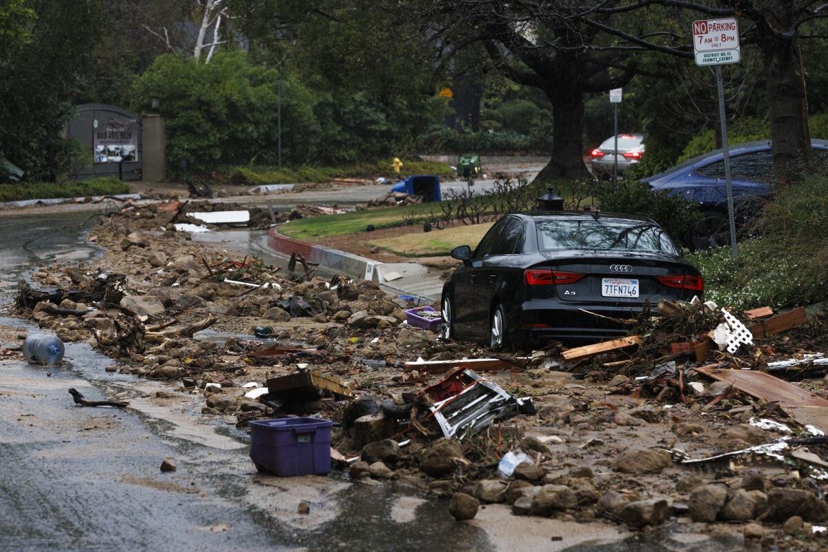
Debris lines the street in front of nine homes that were evacuated due to a landslide from heavy rainfall during the atmospheric river hitting in Studio City.
(Carlin Stiehl / For The Times)
Another active area of research involves estimating how much the severity of a certain extreme weather event, such as a record storm, is attributable to higher temperatures caused by climate change. And how severe the climate-driven intensification becomes is expected to depend on how much more greenhouse gases humans pump into the atmosphere.
Climate scientists note that the rapid rise in global temperatures is now an ever-present factor influencing weather around the world.
“Definitely climate change has made every single weather event different from how it used to be, a little bit,” said Alex Hall, a UCLA climate scientist.
Hall and his colleagues have studied how atmospheric rivers will likely become more extreme with climate change.
Based on the warming that has occurred so far, Hall said, big rain events are generally heavier, “probably somewhere around 10% juicier” than in the past.
“Wherever there is precipitation, it’s probably getting juiced a little bit by the air being warmer and holding more moisture,” Hall said. “And as the climate continues to warm and as warming probably accelerates, the signal will become larger.”

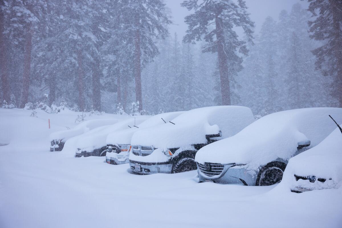
Snow covers a line of parked cars and trucks in Mammoth Mountain.
(Peter Morning / Mammoth Mountain)
Source link


