-
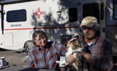
‘This is the home we have left’: Fire victims face deadline to leave RV park - 27 mins ago
-
Jalen Hurts scores third rushing TD of game, extending Eagles' lead vs. Commanders in NFC Championship | NFL Highlights - 29 mins ago
-
Dad Starts Snoring in the Night, 3-Year-Old Knows What to Do - 40 mins ago
-
Auschwitz survivors lay wreaths on 80th anniversary of liberation - 53 mins ago
-
Green Light for Eve Power’s Battery Factory in Debrecen - 55 mins ago
-
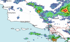
Rain pelts L.A.; Malibu schools shut; I-5 closed at Grapevine - about 1 hour ago
-
Saquon Barkley scores third touchdown of game, extending Eagles’ lead vs. Commanders in NFC Championship | NFL Highlights - about 1 hour ago
-
Israel Arrests Air Defense Operative Suspected of Spying for Iran - about 1 hour ago
-
Demi Moore’s Oscar nomination marks career high after nearly quitting Hollywood - about 1 hour ago
-
Viktor Orbán Explains why He is Not Joining the Euro - about 1 hour ago
Rain heightens flood, mudslide dangers for Los Angeles’ burn areas
With more rain on the way, officials warned Sunday of an increasing risk for mudslides in Los Angeles County’s burn areas, with a 10% to 20% chance of significant flash flooding and debris flows capable of damaging roads and homes in and around areas devastated by wildfires.
“This is the worst-case scenario to prepare for,” said Kristan Lund, a meteorologist with the National Weather Service in Oxnard.
“We do have increasing concern for the burn scars,” Lund said. The charred footprint of the Eaton fire, which blackened more than 14,000 acres, is the most worrisome. “These flash floods and these debris flows could happen in and near or below these burn scars.”
This article is provided free of charge to help keep our community safe and supported during these devastating fires.
A flood watch was set to take effect at 10 a.m. Sunday and continue through 4 p.m. Monday for the burned areas of the Eaton fire in the Altadena and Pasadena areas; the Palisades and Franklin fires in the Pacific Palisades and Malibu areas; the Hughes fire around Lake Castaic; and the Bridge fire in San Gabriel Mountains west and southwest of Wrightwood. The flood watch is starting six hours earlier than originally anticipated.
“The highest risk for debris flows would be after 4 p.m. Sunday,” the weather service said.
If you’re not sure you’re near enough to the burn scar, “assume that you are,” Lund said. However, a city like Montebello — roughly 10 miles away from the burned area of the Eaton fire — is not considered close.
(National Weather Service)
“If you’re close to the fire, you want to be on the prepared side,” Lund said. Steps people can take are to avoid being in or around the area from Sunday afternoon through Monday afternoon; using sandbags to protect property; and, for people who do decide to stay, stocking up on supplies in case road access is blocked.
A “landslide” is an all-encompassing term that can describe any movement of rock, dirt or debris downhill. A “debris flow” can happen when water rapidly flows downhill and, besides mud, picks up rocks, branches and sometimes massive boulders. This is also considered a type of shallow landslide, which can occur with potentially deadly force.
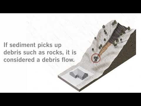
Animated infographic shows a debris flow works
Landslides are a risk after wildfires because the heat of the fire makes the soil repellent to water. When rainfall intensities are high — falling at more than one-half an inch per hour — water can start flowing on the surface downhill, instead of percolating below ground, and can begin to pick up rocks and debris.
“It really has to do with the track of the storm,” Lund said. “They’re the greatest potential for significant debris flows. They’re the most recent burn scars; they’re close to communities or vulnerable infrastructure.”
The orientation of the terrain is also vulnerable in this particular storm. The burn scars are over mountain slopes that face the south, and the moisture from the storm is being pulled in from the south, forecasters say.
Those factors could cause “some more heavier rainfall in those areas,” Lund said.
Forecasted rainfall totals for the three-day storm continue to tick upward. Through Monday, Covina could get 1.32 inches of rain; downtown L.A., 1.14 inches; Long Beach, 1.12 inches; Canoga Park, 1.05 inches; Santa Clarita, 1.04 inches; Fillmore, 1.02 inches; Redondo Beach, 0.95 inch; and Thousand Oaks, 0.87 inch.

(National Weather Service)
Besides the risk for debris flow, there is a potential for waterspouts over the ocean, as well as damaging winds, and strong thunderstorms, Lund said.
And heavier rain can still happen even if you don’t see lightning or hear thunder. But if you do hear or see a thunderstorm, “you’ll likely have higher rainfall rates,” Lund said.
There’s a 15% to 25% chance of thunderstorms developing across a swath of Southern California that includes the recently burned areas, said Carol Smith, a meteorologist with the weather service. Thunderstorms could bring a chance of rainfall rates of half an inch per hour to three-quarters of an inch per hour in isolated areas.
Rainfall rates that exceed one-half an inch per hour can trigger debris flow in burned areas.
Smith said the Palisades fire burn area could see more than an inch of rain; the Eaton fire burn area could get up to 2 inches.

(National Weather Service)
Light rain began falling across the region Saturday night.
The storm will bring the first significant rain of the year. Much of Southern California is in “severe drought” with some areas in the southern most part of the state in “extreme drought,” according to the U.S. Drought Monitor.
Officials advised residents in burn zones to use sandbags to direct runoff and protect property, clear drainage paths, heed evacuation orders and stay off roads covered with debris. They also said residents should keep trash cans and vehicles off the street to allow stormwater to travel freely and avoid contact with polluted runoff.
“If emergency officials say to avoid a certain area, please do that,” Smith said.
Source link
