-
NY Giants Star Issued Jaxson Dart an NFL Reality Check - 14 mins ago
-
NBA Finals Game 2 takeaways: Thunder bounce back to even series 1-1 - 31 mins ago
-
Packers QB Jordan Love Generating Buzz Ahead of 2025 Season - 54 mins ago
-
UFL Top 10 Plays from Conference Championships | United Football League - about 1 hour ago
-
Israeli forces board charity boat bound for Gaza with activist Greta Thunberg aboard - about 1 hour ago
-
Tom Brady Doesn’t Hold Back About Chiefs’ Patrick Mahomes - 2 hours ago
-
2025 UEFA Nations League Finals: Portugal's trophy ceremony following victory over Spain - 2 hours ago
-
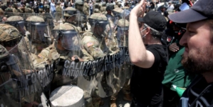
Waymo vehicles set on fire in downtown L.A, as protesters, police clash - 2 hours ago
-
Eagles’ Jalen Hurts, Saquon Barkley Labeled MVP Sleepers - 2 hours ago
-
George Clooney returns to silver fox look for 2025 Tony Awards ceremony - 2 hours ago
Shocking before-after satellite images: Malibu and Altadena
The Palisades and Eaton fires have left tens of thousands of residents evacuated and wondering what may be left of their homes in Pacific Palisades, Altadena and surrounding areas.
New satellite images give the first clear look at some of the neighborhoods most impacted.
The image below shows a famous strip of Malibu homes sandwiched between Pacific Coast Highway and the ocean just west of Topanga Beach.
Most structures of the strip near Tuna Canyon Road were gone by Wednesday, according to infrared satellite images provided by Maxar Technologies.
The Palisades fire, which began Tuesday and burned over 1,000 homes, businesses and other buildings by Wednesday afternoon, spared few homes in this stretch of PCH.
Some 50 miles away in Altadena, the Eaton fire had killed five people and burned dozens of homes as of Wednesday afternoon.
The image below shows homes and businesses on East Altadena Drive before and during the fire.
The satellite infrared image shows dozens of structures ablaze and many more completely destroyed on Wednesday.
The Eaton fire, which broke out Tuesday night, had burned some 10,600 homes in Altadena and Pasadena as of Wednesday afternoon.
Though the neighborhood pictured above was still burning vigorously Wednesday, further northwest the fire had already done horrific damage and left most homes in smoldering ruins.
The satellite photo above, taken over Marathon road in Altadena, showed near-total devastation of homes on Wednesday.
As fire resources were stretched thin, residents of Altadena found themselves battling the flames.
Source link


